Trails for everyone, forever

Home Go Hiking Hiking Guide Mine Creek
link

Mine Creek

Snoqualmie Region > North Bend Area
47.4781, -121.6590 Map & Directions
Length
1.0 miles, roundtrip
Elevation Gain
100 feet
Highest Point
800 feet
Calculated Difficulty About Calculated Difficulty
Easy
A picnic on the Middle Fork. Photo by Dream Delay. Full-size image
  • Dogs allowed on leash
  • Fall foliage
  • Good for kids
  • Mountain views
  • Old growth
  • Rivers
  • Wildflowers/Meadows
  • Wildlife

Parking Pass/Entry Fee

Discover Pass
Saved to My Backpack

Enjoy excellent river access and picnic opportunities on this short, flat and easy loop trail. Continue reading

Rating
5.00 out of 5

(2 votes) Log in to rate

Hiking Mine Creek

Mine Creek is a mellow day use area in the Middle Fork Valley that’s perfect for a low-key day by the water. The main Mine Creek Loop Trail is an easy 0.7- to 1-mile loop that winds through a lush forest lined with salmonberry bushes. While walking, you can still spot a few massive old-growth stumps left over from logging back in the early 1900s.

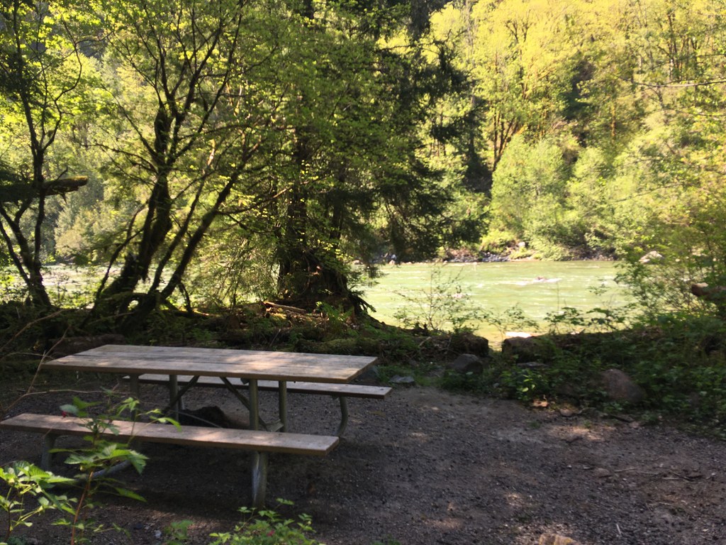
It’s a great place to explore, with three picnic areas right on the river that make for a solid home base. While the main loop is smooth and wide, there are several narrow spur trails that branch off to more secluded river spots. These are a bit more rugged and not ADA-friendly. Also, if you’re heading to the main beach across from the bridge, be ready for a slightly steep, sandy drop-off to get down to the water.

Whether you're stopping for a quick riverside lunch or exploring the mossy relics of the valley's past, Mine Creek is a perfect reminder that you don't always have to climb a mountain to find a great view.

Toilet Information

  • Toilet at trailhead
  • Accessible toilet

More information about toilets

Wheelchair Accessibility

Almost the entire trail is ADA-accessible by design from updates made in 2024.

While the trails are flat and surfaced for accessibility, visitors should note that the gravel is "packed" rather than paved. Because the area is heavily forested, debris like twigs or small branches may occasionally be on the trail surface. Picnic tables and vault toilet are ADA-accessible.

Hike Description Written by
Josh Machniak, WTA Correspondent

Mine Creek

Map & Directions

Trailhead
Co-ordinates: 47.4781, -121.6590 Open in Google Maps

Before You Go

See weather forecast

Parking Pass/Entry Fee

Discover Pass

WTA Pro Tip: Save a copy of our directions before you leave! App-based driving directions aren't always accurate and data connections may be unreliable as you drive to the trailhead.

Getting There

Traveling either east or west on I-90, take exit 34. Turn north onto 468th Avenue and follow it to the junction with SE Middle Fork Road (FR 56). Turn right and continue on SE Middle Fork Road about 2.5 miles. Drive past both the Mailbox Peak and Granite Connector trailheads. The parking areas for Mine Creek will be on your left.

More Hike Details

Trailhead

Snoqualmie Region > North Bend Area

Washington State Department of Natural Resources

Guidebooks & Maps

https://dnr.wa.gov/natural-areas/natural-resources-conservation-areas/middle-fork-snoqualmie-natural-resources-conservation-area

You can improve or add to this guidebook entry!

Mine Creek

11 Trip Reports

Hiked here recently?

Submit a trip report!
 
Loading trip reports...
Trip Reports