Trails for everyone, forever

Home Go Hiking Hiking Guide McNary Dam Nature Area

McNary Dam Nature Area

Central Washington > Tri-Cities
45.9286, -119.3097 Map & Directions
Length
5.0 miles, roundtrip
Elevation Gain
20 feet
Highest Point
315 feet
Calculated Difficulty About Calculated Difficulty
Easy/Moderate
The nature area is a perfect place for birdwatching all year long. Photo by Jay Grate. Full-size image
  • Dogs allowed on leash
  • Good for kids
  • Lakes
  • Rivers
  • Wildflowers/Meadows
  • Wildlife

Parking Pass/Entry Fee

None
Saved to My Backpack

Venture across the Columbia River, just barely into Oregon, and ramble on easy trails where you’ll see and hear a wide variety of birds, mammals and reptiles. Continue reading

Rating
0.00 out of 5

(0 votes) Log in to rate

Hiking McNary Dam Nature Area

Just downstream of McNary Dam — near Umatilla, Oregon, a hair below the Washington-Oregon border — a network of wide, flat trails winds its way among nine ponds, crossing riparian zones, native wetlands and shrub-steppe ecosystems.

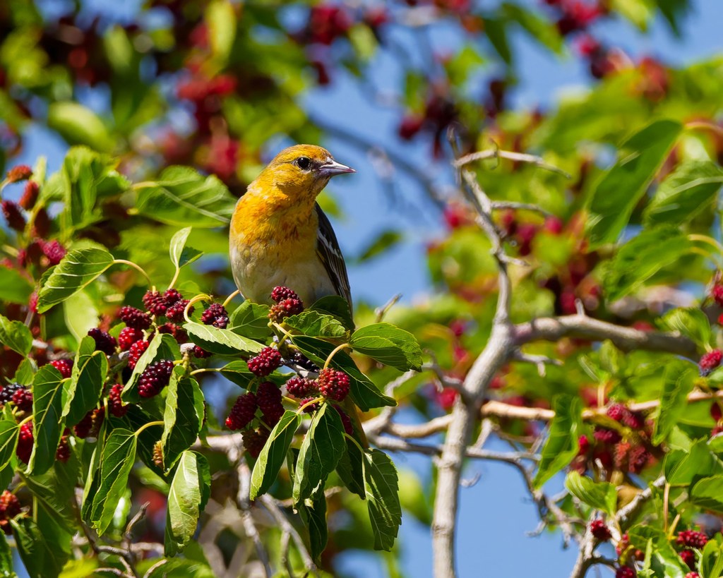
These rich habitats are teeming with wildlife. Over 200 species of birds have been observed here, as well as deer, marmots, beavers, minks, frogs and turtles. With the region’s mild winters, you can check out McNary Dam Nature Area in all four seasons.

One highlight of the area is a “Kids in Parks” TRACK Trail, a 1.5-mile, self-guided path designed for children (and grown-ups) to explore the outdoors. Pick up a brochure or scan a QR code at the Ferry Road trailhead for details. The TRACK loop, and miles of other connecting trails and footbridges, provide lots of space to explore east of Ferry Road.

More trails and gravel roads circle the ponds west of Ferry Road, providing access for fishing, and they are also great for walking and viewing wildlife. The ponds at McNary Dam Nature Area are stocked with trout every spring, but hunting is not allowed. Non-motorized boats are welcome, but there are no boat ramps.\

WTA Pro Tip: While you’re in the neighborhood, visit the Pacific Salmon Visitor Center at Spillway Park to learn about salmon and hydropower.

Toilet Information

  • Toilet at trailhead
  • Accessible toilet

More information about toilets

Wheelchair Accessibility

Although the TRACK loop is shown on the map as ADA-accessible, just north of Tower Pond, there’s a protruding root and a narrow footbridge with a significant step up, so that segment is not wheelchair-friendly. Luckily, there are plenty of other routes without impediments.

Hike Description Written by
Mary Hartman, WTA Correspondent

McNary Dam Nature Area

Map & Directions

Trailhead
Co-ordinates: 45.9286, -119.3097 Open in Google Maps

Before You Go

See weather forecast

Parking Pass/Entry Fee

None

WTA Pro Tip: Save a copy of our directions before you leave! App-based driving directions aren't always accurate and data connections may be unreliable as you drive to the trailhead.

Getting There

From the Tri-Cities, drive east on I-82 about 25 miles and cross the Columbia River into Oregon. Take exit 1 for U.S.730 West toward Umatilla. Turn right at the end of the exit ramp, then another right onto Brownell Boulevard. At the “T,” turn right onto 3rd Street (unmarked). Drive under the freeway about 1 mile, then turn left on Ferry Road. The parking area is about 0.2 mile on the right.

Alternatively, from Walla Walla, head west on U.S. 12. In about 30 miles, continue straight onto U.S. 730 West for about 25 miles. In Umatilla, go under the overpass, turn right onto Brownell Boulevard and follow the directions above.

Trail access is also available on 3rd Street near Fountain Pond, at Spillway Park near the visitor center, and on Brownell Boulevard (west end). Accessible vault toilets are available 0.2 mile beyond the Ferry Road trailhead, at Brownell Boulevard and at Fountain Pond. Accessible flush toilets are available in Spillway Park and at the Pacific Salmon Visitor Center.

More Hike Details

Trailhead

Central Washington > Tri-Cities

U.S. Army Corps of Engineers

Guidebooks & Maps

https://www.nww.usace.army.mil/Locations/District-Locks-and-Dams/McNary-Lock-and-Dam/McNary-Wildlife-Nature-Area/

USGS Umatilla

https://www.kidsinparks.com/location/mcnary-lock-dam

You can improve or add to this guidebook entry!

McNary Dam Nature Area

1 Trip Report

Hiked here recently?

Submit a trip report!
 
Trip Reports