Trails for everyone, forever

Home Go Hiking Hiking Guide Lions Park

Alert: On Oct. 1 the federal government began a partial shutdown that will impact National Parks, National Wildlife Refuges and U.S. Forest Service lands in Washington. Here's the latest information we have for hikers and campers


Lions Park

Olympic Peninsula > Kitsap Peninsula
47.5855, -122.6444 Map & Directions
Length
0.7 miles, roundtrip
Elevation Gain
0 feet
Highest Point
3 feet
Calculated Difficulty About Calculated Difficulty
Easy
Orca sculptures at the park. Photo by RideDive. Full-size image
  • Coast
  • Dogs allowed on leash
  • Good for kids

Parking Pass/Entry Fee

None
Saved to My Backpack

Lions Park is an urban park with a walking loop alongside the Port Washington Narrows. Continue reading

Rating
0.00 out of 5

(0 votes) Log in to rate

Hiking Lions Park

Lions Park offers a refreshing green spot in urban Bremerton. The walking loop can be accessed from either parking area off Lebo Boulevard. The loop does not have trail signage, but it does not need it, as you can see the entire loop from any spot on it. 

Stroll at your own pace, possibly pausing at a bench to watch seals, birds and humans along the 1,900-linear-foot shoreline that edges Port Washington Narrows.

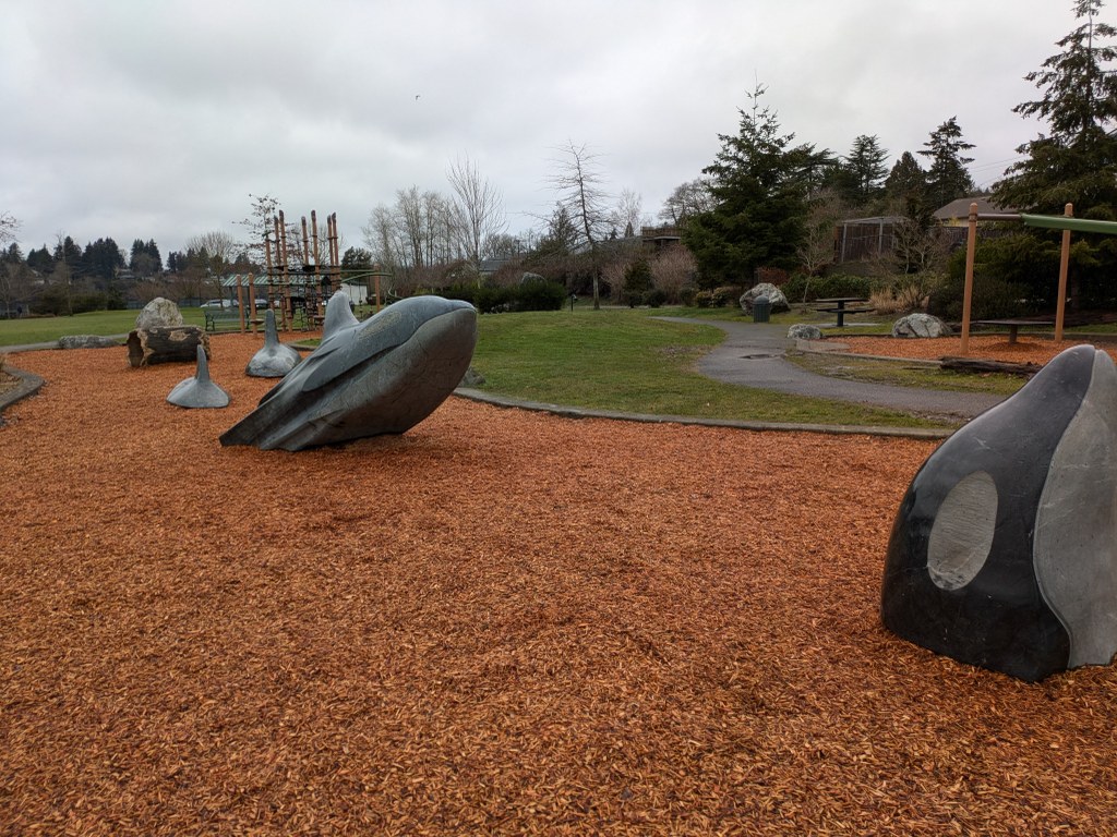
Lions Park has water access, multiple ball fields, picnic areas, a playground and restrooms, making it an easy spot to spend a day alongside the water. 

Extend your hike

This route can easily be extended to the Stephenson Canyon Community Greenway, where another 0.7-mile walk awaits, with a small creek and a seasonal waterfall at the canyon floor. To get there from Lions Park, cross Lebo Boulevard and head North on Hefner Street for 0.1 mile. Turn right onto Elm Street for another 0.1 mile. Turn right onto Sheridan Road, then, at 0.3 mile, turn right onto Birch Street. The trail head is 0.1 mile down Brich Street and is well-signed.

Toilet Information

  • Toilet at trailhead
  • Toilet has running water

More information about toilets

Hike Description Written by
Jen Boyd, WTA Correspondent

Lions Park

Map & Directions

Trailhead
Co-ordinates: 47.5855, -122.6444 Open in Google Maps

Before You Go

See weather forecast

Parking Pass/Entry Fee

None

WTA Pro Tip: Save a copy of our directions before you leave! App-based driving directions aren't always accurate and data connections may be unreliable as you drive to the trailhead.

Getting There

From WA-3 in Bremerton, take exit 38 to merge onto WA-310 East/Kitsap Way. At 1.6 miles, use the left 2 lanes to turn left onto WA-303 N/Warren Avenue. Go 1.2 miles and turn left onto Sheridan Road. Follow Sheridan to Lebo Boulevard. The parking lot is directly across Lebo Boulevard. 

More Hike Details

Trailhead

Olympic Peninsula > Kitsap Peninsula

City of Bremerton

Guidebooks & Maps

http://bremertonwa.gov/facilities/facility/details/lions-park-10

You can improve or add to this guidebook entry!

Lions Park

1 Trip Report

Hiked here recently?

Submit a trip report!
 
Trip Reports