Trails for everyone, forever

Home Go Hiking Hiking Guide John Muir Discovery

Alert: We are still in the midst of an active disaster. Learn more and how you can help.

Landslide risk, tree-fall in saturated soils and related hazards remain very high and have closed trails and roads, including major highways and forest roads. 

Respect closures, check forecasts, consider delaying your hiking or recreation plans, and stay safe out there.


John Muir Discovery

Mount Rainier Area > Chinook Pass - Hwy 410
47.0681, -121.5778 Map & Directions
Length
0.3 miles, roundtrip

12.17.25 - Trailhead inaccessible due to washout on State Route 410 past Enumclaw. (Access through the washout restricted to Greenwater locals and official responders.)

A quiet walk in the woods near the river. Photo by trip reporter hearingjd. Full-size image
Saved to My Backpack

Take a gentle walk next to the White River in an old-growth forest. Continue reading

  • Dogs allowed on leash
  • Good for kids
  • Old growth
  • Rivers
  • Wildlife

Parking Pass/Entry Fee

Northwest Forest Pass
Rating
3.33 out of 5

(3 votes) Log in to rate

Hiking John Muir Discovery

The John Muir Discovery Trail is a 0.3-mile loop trail located in The Dalles Campground and Picnic area. It's a great hike for all ages, from toddlers to the elderly, and while it is not ADA rated, it is a barrier-free trail.

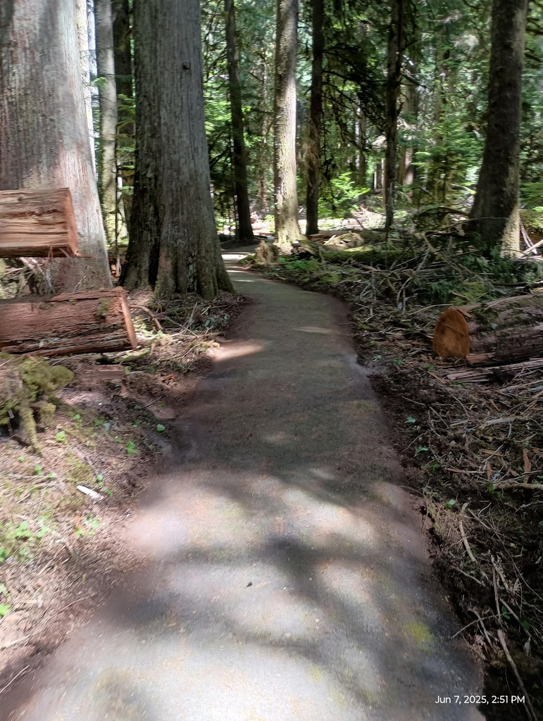
Leaving from near the picnic shelter, this mostly-paved nature walk is nearly flat and smooth surfaced, making it walkable for hikers of all experience levels. You will initially walk towards the river before meeting a "Y" on the left. You can take either branch, as they both lead back to this point.

Starting on the river side of the loop, you will find numerous information boards explaining things you see from the braided channel of the White River to the old-growth cedar trees surrounding you. Watch for signs of elk passing through the area on their way to cross the river. After crossing a newly-repaired bridge, you will begin to loop back to the starting point, walking past huge Douglas Firs, patches of ferns, salal and skunk cabbage before meeting back up with the entrance trail.  

Toilet Information

  • Toilet at trailhead

More information about toilets

Wheelchair Accessibility

The trail is mostly paved with no barriers. One section of trail is damaged and has tamped gravel on it, while awaiting asphalt.

WTA worked here in 2015!

John Muir Discovery

Map & Directions

Trailhead
Co-ordinates: 47.0681, -121.5778 Open in Google Maps

Before You Go

12.17.25 - Trailhead inaccessible due to washout on State Route 410 past Enumclaw. (Access through the washout restricted to Greenwater locals and official responders.)

See weather forecast

Parking Pass/Entry Fee

Northwest Forest Pass

WTA Pro Tip: Save a copy of our directions before you leave! App-based driving directions aren't always accurate and data connections may be unreliable as you drive to the trailhead.

Getting There

Head east on SR-410 from Enumclaw towards Chinook Pass. Go through the town of Greenwater, then go 7.5 miles further.  Look for the entrance to The Dalles Campground on your right, turn in, and go straight ahead to the picnic and day-use area. 

More Hike Details

Trailhead

Mount Rainier Area > Chinook Pass - Hwy 410

John Muir Discovery (#1204)

Mt. Baker-Snoqualmie National Forest, Snoqualmie Ranger District

You can improve or add to this guidebook entry!

John Muir Discovery

4 Trip Reports

Hiked here recently?

Submit a trip report!
 
Loading trip reports...
Trip Reports