Trails for everyone, forever

Home Go Hiking Hiking Guide Jackson Creek Fish Camp

Jackson Creek Fish Camp

Central Washington > Tri-Cities
46.6295, -119.8687 Map & Directions
Length
1.4 miles, roundtrip
Elevation Gain
10 feet
Highest Point
446 feet
Calculated Difficulty About Calculated Difficulty
Easy
Umtanum Ridge rises out of the Columbia River across from Jackson Creek Fish Camp. Photo by Mary Hartman. Full-size image
  • Dogs allowed on leash
  • Established campsites
  • Good for kids
  • Rivers
  • Wildflowers/Meadows

Parking Pass/Entry Fee

None
Saved to My Backpack

The Columbia River flows past arid land and steep hills, creating an inviting place for fishing and recreation. Continue reading

Rating
0.00 out of 5

(0 votes) Log in to rate

Hiking Jackson Creek Fish Camp

The Grant County Public Utility District has developed several camping areas that are popular with Columbia River fishermen. One of these is the Jackson Creek Fish Camp, just downstream of Priest Rapids Dam.

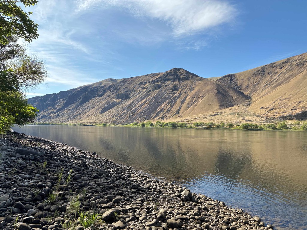
A 0.2-mile trail of loose gravel connects the day use area to the campground. There’s also a short, narrow sidewalk that angles down to the river. Hang out for a little while, and you’re likely to see fish jumping and hear birds singing.

If you’d like to extend your walk, pass through the pedestrian gate at the west end of the day use area. You’ll find a dirt road that curves north along the creek that flows out of Moran Slough. The dirt road ends at an access road for the Moran Slough dike dam (signed for no public access). When you get there, you can either turn right and return via the fish camp access road, or go back the way you came.

The camping area has 10 campsites (two are ADA compliant), an accessible vault toilet and a picnic shelter, but no drinking water. Summer days are very hot, and the picnic shelter offers the only shade. The day-use area also has an accessible vault toilet.

While you’re in the area, stop in at the Wanapum Heritage Center at Priest Rapids Dam. You’ll find a wealth of thought-provoking exhibits about the Wanapum People. There is no charge for admission, but check their website for operating hours.

Note: If you are fishing, boating or wading, be aware that river levels can change rapidly, depending on the operation of Priest Rapids Dam. It is not unusual for water levels to rise and fall 6 feet or more in a short time.

Toilet Information

  • Toilet at trailhead
  • Accessible toilet

More information about toilets

Hike Description Written by
Mary Hartman, WTA Correspondent

Jackson Creek Fish Camp

Map & Directions

Trailhead
Co-ordinates: 46.6295, -119.8687 Open in Google Maps

Before You Go

See weather forecast

Parking Pass/Entry Fee

None

WTA Pro Tip: Save a copy of our directions before you leave! App-based driving directions aren't always accurate and data connections may be unreliable as you drive to the trailhead.

Getting There

From Vantage, cross the Columbia River on I-90 and take exit 137. Drive south on WA-26 for 1 mile, then turn right on WA-243. Drive about 22 miles, past Priest Rapids Dam, and watch for a sign for Jackson Creek Fish Camp. Turn right and drive 1 mile to the day-use area.

From the Tri-Cities, drive west on WA-240. At about 30 miles, continue straight on WA-24. After crossing the Vernita Bridge over the Columbia River, turn left onto WA-243, drive 6 miles, and watch for the sign for Jackson Creek Fish Camp. Turn left and drive 1 mile to the day-use area.

More Hike Details

Trailhead

Central Washington > Tri-Cities

Grant County Public Utility District

Guidebooks & Maps

https://509river.org/campsites/jackson-creek-fish-camp/

USGS Priest Rapids NE

You can improve or add to this guidebook entry!

Jackson Creek Fish Camp

2 Trip Reports

Hiked here recently?

Submit a trip report!
 
Loading trip reports...
Trip Reports