Trails for everyone, forever

Home Go Hiking Hiking Guide Hockinson Meadows Community Park

Hockinson Meadows Community Park

Southwest Washington > Vancouver Area
45.7028, -122.5005 Map & Directions
Length
3.0 miles, roundtrip
Elevation Gain
7 feet
Highest Point
285 feet
Calculated Difficulty About Calculated Difficulty
Easy
The Perimeter Trail with fall colors. Photo by Jaime Weber. Full-size image
  • Dogs allowed on leash
  • Good for kids

Parking Pass/Entry Fee

None
Saved to My Backpack

This 240-acre park has short walking trails, baseball fields, soccer fields, disc golf, a playground, a picnic shelter and an off-leash dog area. Continue reading

Rating
0.00 out of 5

(0 votes) Log in to rate

Hiking Hockinson Meadows Community Park

This popular county park has several options to build loop trails. Adding an extension with the newly developed trail around the perimeter of the disc golf, a 3-mile loop can be enjoyed along a variety of trail surfaces. 

To begin, from the second, larger parking lot (pass the right turn of the first parking lot as you enter the park), head into the park and quickly take a left at the four-way intersection on the soft trail to begin your longer loop around the perimeter. In the winter, waterproof shoes on this section will be helpful as there can be muddy spots.

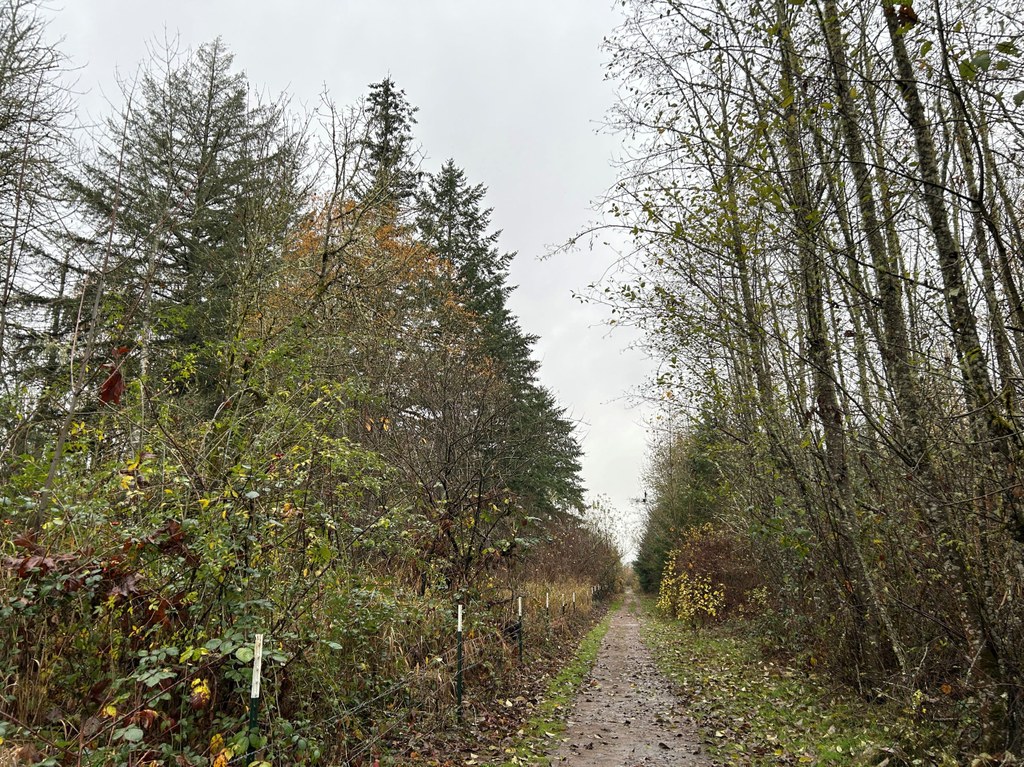
The forested trail follows the park boundary west before turning right (north) — take care along these sections as some of the boundary is marked with barbed wire fencing that can be near the trail. You’ll then turn right again (east) and start to see the disc golf course through the trees as you continue to follow the park boundary.

At about a mile, you’ll come to the intersection with the disc golf course. Cross into the course on a short bridge and extend your walk with the 1-mile loop around the course. Returning across the bridge where you entered, you can extend the loop by continuing to head west around the first parking lot and the park entrance or return to the second parking lot by taking the interior path by the playground and past the off-leash dog park.

For a shorter, 1-mile lollipop loop, at the starting 4-way trail intersection, head directly into the interior of the park by staying straight, winding your way through the park to the playground and second parking lot and then looping back the way you came.

Toilet Information

  • Toilet at trailhead

More information about toilets

WTA worked here in 2025!

Hike Description Written by
Jaime Weber, WTA Correspondent

Hockinson Meadows Community Park

Map & Directions

Trailhead
Co-ordinates: 45.7028, -122.5005 Open in Google Maps

Before You Go

See weather forecast

Parking Pass/Entry Fee

None

WTA Pro Tip: Save a copy of our directions before you leave! App-based driving directions aren't always accurate and data connections may be unreliable as you drive to the trailhead.

Getting There

From downtown Vancouver, head north on I-5 and take exit 2 for WA-500 E. Continue on WA-500 E for 5.3 miles. At the intersection with NE Fourth Plain Blvd, turn right (signs for Camas), and continue for 1.6 miles. Turn left onto NE Ward Rd. In 2 miles, turn left onto NE 172nd Ave. In 0.6 mile, turn left onto NE 109th St. In 0.2 mile, the park will be on your right.  

The park is open daily from 7 a.m. to dusk. 

More Hike Details

Trailhead

Southwest Washington > Vancouver Area

Clark County Parks

Guidebooks & Maps

https://clark.wa.gov/public-works/hockinson-meadows-community-park

You can improve or add to this guidebook entry!

Hockinson Meadows Community Park

1 Trip Report

Hiked here recently?

Submit a trip report!
 
Loading trip reports...
Trip Reports