Trails for everyone, forever

Home Go Hiking Hiking Guide Granny View Overlook

Granny View Overlook

Southwest Washington > Columbia River Gorge - OR
45.4099, -116.7422 Map & Directions
Length
0.4 miles, roundtrip
Elevation Gain
57 feet
Highest Point
6,422 feet
Calculated Difficulty About Calculated Difficulty
Easy
You can see some of the effects from the Double Creek Fire of 2022 on this trail. Photo by Austin Smith. Full-size image
Saved to My Backpack

Granny View Overlook might not be a hike that you’d drive to by itself, but you’d be a fool to pass by it. Continue reading

Rating
0.00 out of 5

(0 votes) Log in to rate

Hiking Granny View Overlook

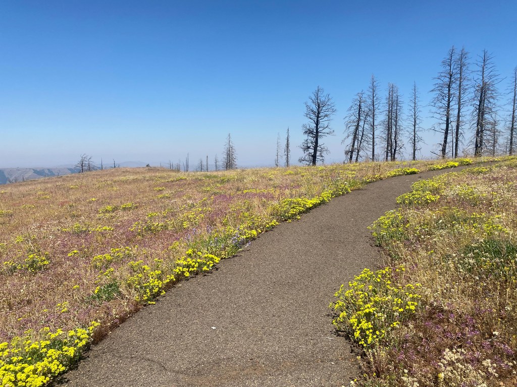
This short loop hike hangs on the arid hillsides 3,700 feet above the Inmaha River. The crusty hillsides of Southeast Oregon stretch out before you cut deeply by eons of water’s action. In midsummer, this modest trail boasts a desert floral show not to be rivaled.

As of 2024, the loop requires a little off-trail navigation. The Double Creek Fire of 2022 destroyed some of the wooden trail structures. Originally, the trail was built as an ADA-compatible experience. Frost heaves, weeds and the fire have made full access a bit of a challenge.

There are excellent bathroom facilities here. Do not miss visiting the Imnaha Store when passing through town. Dispersed camping and Forest Service campgrounds are abundant here. Keep your eyes open for tall 6-foot cairns in this area. Rumor has it that they were built by the Nez Perce identifying their land in the early 19th century.

Hike Description Written by
Austin Smith, WTA Correspondent

Granny View Overlook

Map & Directions

Trailhead
Co-ordinates: 45.4099, -116.7422 Open in Google Maps

Before You Go

See weather forecast

WTA Pro Tip: Save a copy of our directions before you leave! App-based driving directions aren't always accurate and data connections may be unreliable as you drive to the trailhead.

Getting There

From Enterprise, Oregon, travel south 6 miles on Highway 82 towards Joseph. In Joseph, turn left on Highway 350 and go 30 miles to Imnaha, Oregon. In Imnaha, travel about 16.5 miles on Forest Road 2640 (Hat Point Road) to the interpretive area entrance on the right side of the road.

ADVISORY: Forest Road 2640 is very steep, and narrow. Low clearance vehicles, RVs and vehicles pulling trailers are advised to use caution when traveling the lower sections of this road. The road can also be slippery when wet or frozen and, is not recommended for trailers in the late fall and winter.

More Hike Details

Trailhead

Southwest Washington > Columbia River Gorge - OR

Wallowa-Whitman National Forest

You can improve or add to this guidebook entry!

Granny View Overlook

1 Trip Report

Hiked here recently?

Submit a trip report!
 
Loading trip reports...
Trip Reports