Trails for everyone, forever

Home Go Hiking Hiking Guide Foothills Trail

Foothills Trail

Puget Sound and Islands > Seattle-Tacoma Area
47.1841, -122.2447 Map & Directions
Length
21.0 miles, one-way

The Spiketon Ditch Bridge is closed due to damage. Pierce County does not recommend taking any detours due to a lack of bike/pedestrian facilities. The bridge is expected to open by summer 2025.

The Carbon River along the Foothills Trail. Photo by Al.
  • Dogs allowed on leash
  • Good for kids
  • Mountain views
  • Rivers
  • Wildlife

Parking Pass/Entry Fee

None
Saved to My Backpack

This trail runs from Puyallup to Buckley, along the way passing along the Carbon River and offering up great views of Mount Rainier. It is popular with cyclists, walkers and horseback riders. Continue reading

Rating
5.00 out of 5

Hiking Foothills Trail

This is a paved trail that stretches for 21 miles between eastern Puyallup and the White River in the town of Buckley.
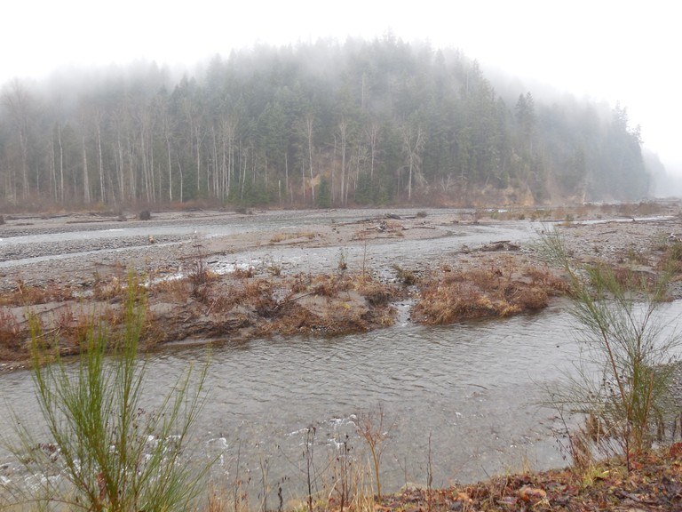
Along the way it parallels the Carbon River for a stretch just east of Orting. This section, the Orting to South Prairie 11-mile stretch, is probably the most scenic section as it passes through farms and forests and offers views of Mount Rainier. Because it passes along two salmon bearing streams, there's a good chance you will also see eagles around the islands in the middle of the river.

The trail continues east to the town of Buckley where it ends at the shore of the White River. The trail connects with the Enumclaw Trail via the White River Bridge.

This trail is popular with cyclists, hikers, and horseback riders, and there are several trailheads of varying lengths depending on the stretch you would like to travel.

Toilet Information

  • Toilet at trailhead
  • Accessible toilet

More information about toilets

Wheelchair Accessibility

The Foothills Trail is largely paved, with some sections of gravel or boardwalk. A 15-mile section between Puyallup and South Prairie is paved, and the trailheads along this section are wheelchair-friendly.

There are also 2 miles near Buckley of paved trail near Buckley on the way to Cascade Junction.

This trail has a low grade for most of its length, and very little side slope.

Hike Description Written by
Charlie Wakenshaw, WTA Staff

Foothills Trail

Map & Directions

Trailhead
Co-ordinates: 47.1841, -122.2447 Open in Google Maps

Before You Go

The Spiketon Ditch Bridge is closed due to damage. Pierce County does not recommend taking any detours due to a lack of bike/pedestrian facilities. The bridge is expected to open by summer 2025.

See weather forecast

Parking Pass/Entry Fee

None

WTA Pro Tip: Save a copy of our directions before you leave! App-based driving directions aren't always accurate and data connections may be unreliable as you drive to the trailhead.

Getting There

For the East Puyallup trailhead: From I-5 take exit 137 and head south on 54th Ave E. for a total of 3.7 miles as it becomes Valley Ave E. Turn right onto N Meridian Ave then immediately use the left lanes to turn left onto the WA 167 on-ramp. After 1.3 miles on WA 167, exit on the right to WA 410. After 1.5 miles on WA 410, exit on the right for WA 162 (Valley Ave E). Stay on this for 0.5 miles, then turn right onto 80th St E for 0.8 mile before arriving at the trailhead on the left. There is parking for 23 cars and a toilet.

For the McMillan Trailhead: The McMillin Trailhead is on the right directly after the cement bridge near where the Puyallup and Carbon Rivers meet, about 2 miles northwest of Orting. It is just north of the intersection of 140th St E and Highway 410 and has room for about 20 cars.

For the Orting Trailhead: From Highway 167 or Highway 512, take the Highway 410 exit, then take the Orting / Sumner exit, which is Route 162. Turn right towards Orting. The Orting trailhead is 2.2 miles further on the right located in the Orting City Park. There is parking available for several vehicles, as well as a toilet.

For the South Prairie Trailhead: From the intersection of highway 167 and Highway 410, drive east for 5.7 miles on Highway 410. Then turn right onto S. Prairie Road E and continue about 4 miles. Turn right onto Pioneer Way E and look for the South Prairie trailhead sign.

For the trailhead in Buckley: From Highway 410, turn south onto Highway 165, and the trailhead will be on the south side of the road.

Take Transit

Route 409 stops at the intersection of Main Ave E and Shaw Road E, which is about a mile walk to the trailhead in Puyallup.

More Hike Details

Trailhead

Puget Sound and Islands > Seattle-Tacoma Area

Pierce County Parks

Guidebooks & Maps

http://www.co.pierce.wa.us/1388/Trail-Map

http://www.piercecountytrails.org/trail-maps/

You can improve or add to this guidebook entry!

Foothills Trail

38 Trip Reports

Hiked here recently?

Submit a trip report!
 
Trip Reports