Trails for everyone, forever

Home Go Hiking Hiking Guide Fish Creek

Fish Creek

Central Cascades > Entiat Mountains/Lake Chelan
48.2380, -120.6074 Map & Directions
Length
8.9 miles, one-way
Elevation Gain
5,650 feet
Highest Point
6,715 feet
Calculated Difficulty About Calculated Difficulty
Hard
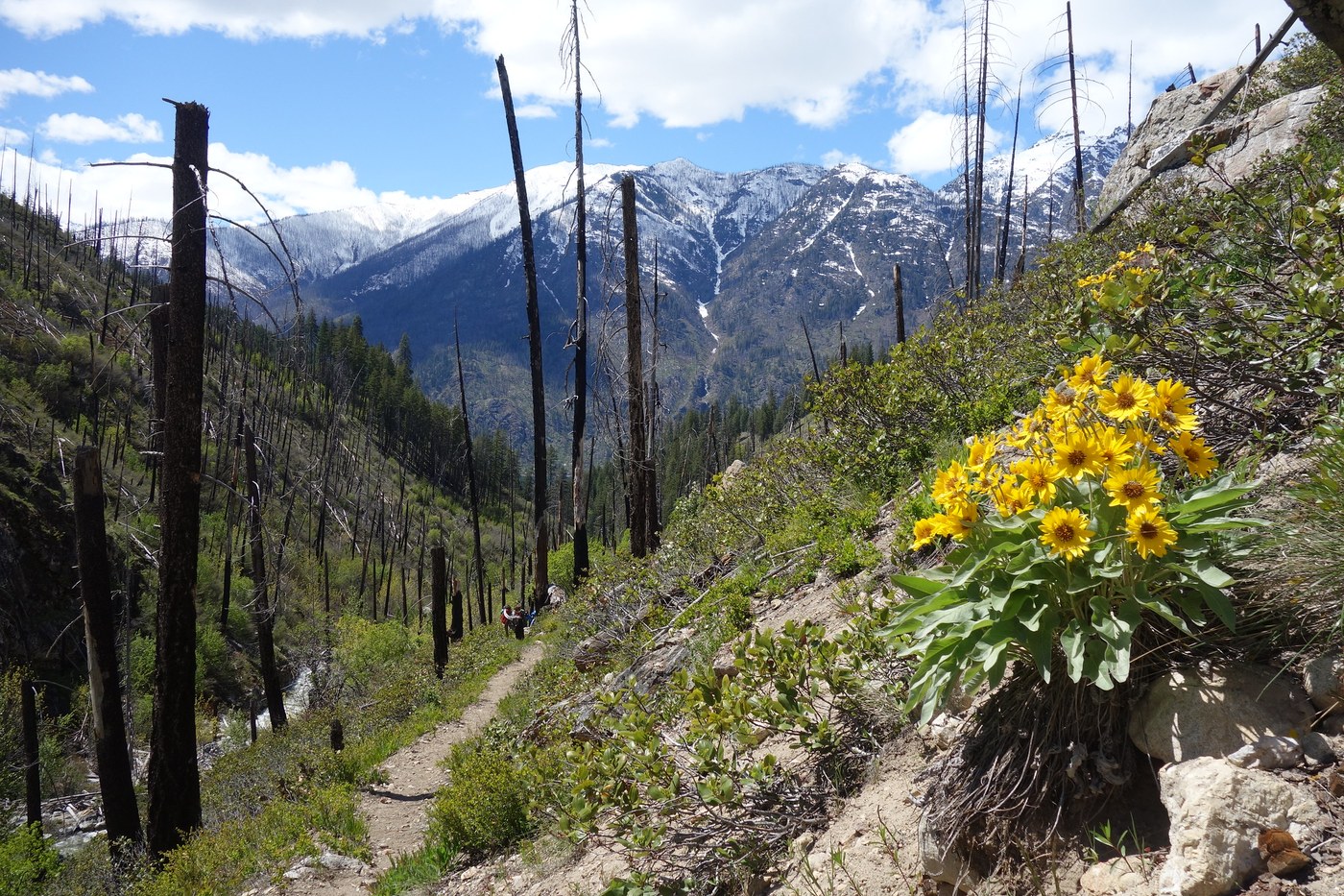
Blooming balsamroot in the springtime on Fish Creek. Photo by Pam MacRae. Full-size image
  • Dogs allowed on leash
  • Established campsites
  • Lakes
  • Mountain views
  • Rivers

Parking Pass/Entry Fee

None

Fish Creek connects the shore of Lake Chelan with the Chelan Summit Trail to the east. Continue reading

Rating
3.20 out of 5

(5 votes) Log in to rate

Hiking Fish Creek

Fish Creek connects the shore of Lake Chelan with the Chelan Summit Trail to the east.

The trail starts from the Lakeshore Trail about 0.25 mile uplake from the bridge over Fish Creek. If you are coming from Moore Point, the Moore Point Trail will intersect the Lakeshore Trail at the bridge. If coming from the Fish Creek dock, you will arrive at the Lakeshore Trail about 0.25 mile uplake from the Fish Creek Trail junction.

The trail is exposed to the sun for about 4 miles once you leave the unburned forest about 1 mile from the junction. The trail climbs steadily traversing bare hillsides that are largely gravel and sand that erode constantly onto the trail. 

After about 2 miles, arrive at the Round Lake junction. This is the only water between the Fish Creek Bridge and Dilly Dally Camp at 4.5 miles. 

The trail switchbacks briefly up a steep grade before resuming the straight traverse above the creek. 

Dilly Dally Camp at 4.5 miles is the only camp along the trail. Primitive (dig catholes), but nice, small tent pads close to Fish Creek for water. The 2024 Pioneer Fire burned all the shade trees, so most campsites are exposed.

The trail continues climbing another 0.75 mile to the East Fork Fish Creek trail.

Another mile brings you into the unburned forest and to a nice easy trail that crosses Fish Creek a couple of times before the final push up to the Summit Trail.

Note: The trail is usually snow covered in the forested above the East Fork junction area up to the Summit Trail into late June. The trail will be hot May to August as there is little to no shade and full sun exposure from morning to early evening.

Toilet Information

  • Toilet at trailhead

More information about toilets

WTA worked here in 2026, 2025, 2024, 2023 and 2022!

Fish Creek

Map & Directions

Trailhead
Co-ordinates: 48.2380, -120.6074 Open in Google Maps

Before You Go

See weather forecast

Parking Pass/Entry Fee

None

WTA Pro Tip: Save a copy of our directions before you leave! App-based driving directions aren't always accurate and data connections may be unreliable as you drive to the trailhead.

Getting There

To reach the west end of the Fish Creek trail, hikers will need to catch the Lady of The Lake ferry from either the city of Chelan or Field's Point Landing. When you get tickets, tell the ferry staff you need a drop at Moore Point. Be sure to have reservations for the boat, as it can fill quickly in the summer months.

The ferry will drop you off at the Moore Point Campground when the lake is high enough to use the Moore Point dock.  When the lake is too low, you will land at the Fish Creek dock (early season April to May, possibly early June; ask the boat company which dock they will use), about 0.75 mile from Moore Point.

More Hike Details

Trailhead

Central Cascades > Entiat Mountains/Lake Chelan

Fish Creek (#1248)

Okanogan-Wenatchee National Forest, Methow Valley Ranger District

You can improve or add to this guidebook entry!

Fish Creek

15 Trip Reports

Hiked here recently?

Submit a trip report!
 
Loading trip reports...
Trip Reports