

One day, the Columbia Plateau Trail, which is an abandoned railroad grade that runs from Pasco to Spokane, may be a paved bike trail for its entire length. Until then, however, day hikers can enjoy short sections. This section starts near the Lower Monumental Dam on the Snake River and goes about 6 miles to the small town of Kahlotus. You might consider pre-positioning a bicycle or second vehicle in Kahlotus to get back to your car. There is a restaurant in Kahlotus that is open for lunch some days.
Start at Devils Bench campground, next to Lower Monumental Dam, where there is ample parking. The first task is to reach the railroad grade, which is some 200 feet above the Snake River at this point. A steep dirt road leads up to the railroad grade in about a quarter mile. Lower Monumental Dam and Lake Herbert G. West behind it are in full view. Once at the grade, turn right and arrive at the first tunnel on the route. This one is about half a mile long and a headlamp would be very useful. After exiting the tunnel, continue north along the grade.
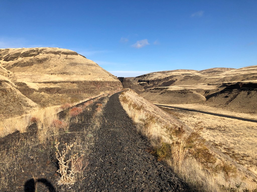
Cuts and fills follow. The surface of the trail is still the original railroad ballast consisting of 3-inch gravel, so the walking is not particularly easy. Otherwise, the trail is wide and in good shape, without much encroaching vegetation. You walk up Devils Canyon, which narrows considerably toward its end. At first, the grade is far above the paralleling SR 263, but towards the north end of Devils Canyon, the highway climbs well above the trail. About the only traffic on the road are trucks shipping grain from the Palouse wheat fields to the barge loading station on the Snake at Windust.
Soon enough reach the second tunnel, which is just outside Kahlotus. This one is about 0.4 mile long. Shortly after exiting the tunnel, a short path leads left to the highway and Kahlotus. If you left a bike here, the ride back to your car is mostly downhill.
This trail is a nice introduction to the Columbia Plateau Trail. Devils Canyon is scenic and this trail is clearly not used very much. You are likely to have the trail to yourself, and might not even encounter any cars on the road to the trailhead.
WTA Pro Tip: This trail is incredibly exposed; it's probably best to avoid hiking it the hottest and coldest days of the year.
 Trailhead


