Trails for everyone, forever

Home Go Hiking Hiking Guide Cedar Creek

Cedar Creek

Southwest Washington > Columbia River Gorge - WA
45.8322, -121.7953 Map & Directions
Length
6.0 miles, roundtrip
Elevation Gain
1,365 feet
Highest Point
4,202 feet
Calculated Difficulty About Calculated Difficulty
Moderate
The infrequently-used Cedar Creek Trail. Photo by Susan Saul. Full-size image
  • Dogs allowed on leash
  • Fall foliage
  • Summits
  • Wildflowers/Meadows

Parking Pass/Entry Fee

None
Saved to My Backpack

This lightly used connector trail to the Pacific Crest Trail provides an easier “back door” approach to Big Huckleberry Mountain on an in-and-out hike. Continue reading

Rating
0.00 out of 5

(0 votes) Log in to rate

Hiking Cedar Creek

This short trail between FR 68 and the Pacific Crest Trail is the last remnant of a long trail that once came up from the Panther Creek valley. 

From Forest Road 68 (elevation 3,075 feet), the trail ascends steeply at first through a Douglas-fir forest with Oregon-grape, vanilla leaf and inside-out flower in the understory. The grade soon eases and the climb becomes more gradual and rolling as the trail crosses two dry drainages, one marked by devil’s club.

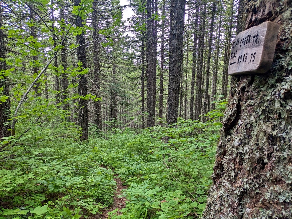
Passing over a divide, the trail descends past a campsite to cross over Cedar Creek on rocks at an easy ford at 0.4 miles. The trail then climbs steeply up the slope for 0.3 mile and gains 300 feet to meet the PCT (elevation 3,615 feet).

To continue to Big Huckleberry Mountain, turn right on the PCT and hike north on this well-graded trail for 1.7 miles. Switchback up twice, then ascend below a ridge crest. The trail traverses below rocky outcroppings filled with wildflowers in spring and early summer. A couple of short spur paths lead out onto a rocky, flower-filled outcrop with a view south to Mount Defiance and Mount Hood.

Continuing on the PCT, cross another bald and then switchback up again. As the trail runs east along the ridge crest through huckleberry and beargrass, reach a junction with Grassy Knoll Trail 146 (elevation 3,995 feet). Continue straight ahead for about 50 feet to the junction with the Big Huckleberry Mountain Trail 135.

Turn right and ascend steeply for about 0.3 mile to an open bald filled with wildflowers like showy phlox, upland larkspur and scalloped onion in late spring-early summer. A few cables and shards of melted glass mark the location of the former fire lookout on the summit (elevation 4,202 feet), which was probably removed in the 1960s.

Since then, the trees have grown up and now restrict the views, but hikers can wander around the broad top for peeks at Mount Adams and better views south to Mount Hood and the Columbia River Gorge. Look for bright pink rock penstemon, red-orange paintbrush and yellow balsamroot around the rocky summit.

WTA Pro Tip: Mid to late June is the perfect time to catch the wildflower bloom.

Toilet Information

  • No toilet at trailhead

More information about toilets

Hike Description Written by
Susan Saul, WTA Correspondent

Cedar Creek

Map & Directions

Trailhead
Co-ordinates: 45.8322, -121.7953 Open in Google Maps

Before You Go

See weather forecast

Parking Pass/Entry Fee

None

WTA Pro Tip: Save a copy of our directions before you leave! App-based driving directions aren't always accurate and data connections may be unreliable as you drive to the trailhead.

Getting There

From Vancouver, drive SR 14 east 45 miles to Stevenson. Pass through Stevenson and in 4 miles reach a roundabout, making a left exit for Carson and the Wind River Recreation Area.

Drive north through Carson on the Wind River Road for 5.8 miles. Turn right onto Old State Road at a sign for Panther Creek Campground. Turn left in 0.1 miles onto Panther Creek Road; after 0.9 miles it becomes Forest Road 65.

Drive this paved road for 4.7 miles. Make a sharp right turn onto gravel Forest Road 68. The road number sign is not visible until after you make the turn.

Drive 2.1 miles on this badly potholed road to a T-intersection with FR 6801. Bear right and drive another 2.6 miles, climbing over the ridge to a junction where the Pacific Crest Trail crosses FR 68.

Drive onward for another 3.8 miles with fewer potholes than at the beginning of this road. Look up to your left for a sign on a tree denoting Cedar Creek Trail 149.

Park in the pull-off on the road shoulder across from the sign (space for two cars). A second pull-off up the road is also large enough for two cars; it is wider and good for turning around.

More Hike Details

Trailhead

Southwest Washington > Columbia River Gorge - WA

Gifford Pinchot National Forest/Mount Adams Ranger District

Guidebooks & Maps

Green Trails Wind River, WA No. 397

Buy the Green Trails Wind River No. 397 map

You can improve or add to this guidebook entry!

Cedar Creek

2 Trip Reports

Hiked here recently?

Submit a trip report!
 
Loading trip reports...
Trip Reports