
This seldom-used trail on the Mountain Loop Highway presents hikers with the opportunity to explore and learn about the area’s history from the moment the car doors open at the trailhead. An information board details some key historic facts and provides photos from yesteryear to help visitors appreciate the history of this special place.
Starting from the site of a former Forest Service Guard Station, the trail takes off through the forest, quickly reaching a signed junction. The trail right continues to Barlow Point, while the trail left follows a portion of the Everett-Monte Cristo railroad grade and has an interpretive sign to provide further information about the rail history of the surrounding area. In a short distance, this spur trail rejoins the Barlow Point Trail and makes a nice detour either on the way up or the way down.
Continuing on the Barlow Point Trail, pass two more signed junctions; the first being where the railroad grade rejoins the main trail and the second being the start of the Old Government Trail. Immediately after this junction, a steady series of switchbacks propels hikers up through forest scarred by the Buck Creek Fire in 1905.
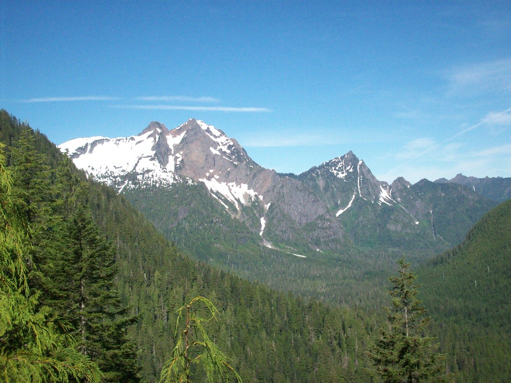
The rocky summit of Barlow Point is soon reached. This point housed a lookout tower from 1935 until 1964 when, ironically, it burned down. Because the surrounding forest had burned in the 1905 fire, the Barlow Point fire lookout had unobstructed views in all directions. The forest has since regrown and some of the views are now blocked by evergreens, but visitors can still enjoy the scenery of both the Stillaguamish and Sauk River valleys along with a number of rocky peaks lining the horizon.
Barlow Point

-
 Length
- 2.4 miles, roundtrip
-
 Elevation Gain
- 800 feet
-
 Highest Point
- 3,200 feet
From Barlow Point’s rocky promontory, hikers can take in views of Mount Dickerman, Big Four, and Stillaguamish Peak.
Continue reading
Hiking Barlow Point

WTA worked here in 2024, 2023, 2021 and 2017!
Map & Directions
 Trailhead
Before You Go
Parking Pass/Entry Fee
Northwest Forest PassWTA Pro Tip: Save a copy of our directions before you leave! App-based driving directions aren't always accurate and data connections may be unreliable as you drive to the trailhead.
Getting There
Take Highway 92 to its end in Granite Falls. At the T intersection near the east end of town, turn left onto the Mountain Loop Highway. Follow this road 11 miles to the Verlot Ranger Station for maps, permits, and latest trail information (during the week).
19.3 miles past the ranger station is Barlow Pass and the end of paved road. Here you will find a parking lot on the left (north) side of the road.
Parking is available both on the road and at a Forest Service trailhead parking lot near the end of the paved road. Restrooms are available here as well.


