Trails for everyone, forever

Home Go Hiking Hiking Guide Aurora Ridge

Aurora Ridge

Olympic Peninsula > Northern Coast
48.0617, -123.9945 Map & Directions
Length
16.8 miles, roundtrip
Elevation Gain
3,000 feet
Highest Point
4,610 feet
Calculated Difficulty About Calculated Difficulty
Hard
Aurora Ridge in fall foliage. Full-size image
  • Dogs not allowed
  • Established campsites
  • Fall foliage
  • Lakes
  • Mountain views
  • Old growth
  • Ridges/passes
  • Summits
  • Wildlife

Parking Pass/Entry Fee

National Park Pass
Saved to My Backpack

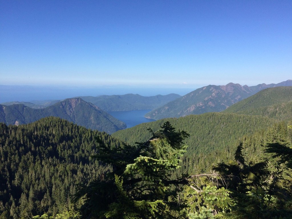
The Aurora Ridge Trail is welcome for those who love solitude, and great views of Lake Crescent, Ediz Hook, Mount Baker, Mount Olympus, and Glacier Peak can all be seen from Sourdough Peak and along the ridge. Continue reading

Rating
3.17 out of 5

(6 votes) Log in to rate

Hiking Aurora Ridge

Start hiking from the small but lightly-used trailhead parking area through the old-growth forest. It begins to climb steeply, but when you reach the ridge, it's mostly flat.

After a steep 2.5 miles, the trail comes to the ridge. You won't enjoy views yet, but the worst is behind you since the vertical climb has leveled out and small views open up, promising more the further you go. At 5 miles, the mildly primitive path comes to a junction with the Eagle Lakes Trail. Eagle Lakes are small but pretty lakes about a half-mile from here. Eagle Lakes is a great place to go bird watching.

Three miles past this junction, you'll come to the Sourdough Mountain junction. Sourdough Mountain rises 300 feet above the ridge and has fantastic views.

The peak is only 2,000 feet from here and is worth it. The summit elevation is 4,610 feet, which marks the highest point on the hike. Continue back the way you came or traverse further on top of the ridge. Past the peak junction, the trail goes all the way to the Happy Lake Ridge. But as a day hike, the peak and back is enough.

Toilet Information

  • No toilet at trailhead

More information about toilets

WTA worked here in 2018 and 2010!

Hike Description Written by
Multiple authors contributed to this report, WTA Community

Aurora Ridge

Map & Directions

Trailhead
Co-ordinates: 48.0617, -123.9945 Open in Google Maps

Before You Go

See weather forecast

Parking Pass/Entry Fee

National Park Pass

WTA Pro Tip: Save a copy of our directions before you leave! App-based driving directions aren't always accurate and data connections may be unreliable as you drive to the trailhead.

Getting There

Driving west on Highway 101 from Port Angeles. Drive past Lake Crescent and turn left on the Sol Due. You will need a park pass in the summer. Approximately 2 miles past the entrance of the Sol Duc the trail head parking is on the left. Room for about five vehicles. 

More Hike Details

Trailhead

Olympic Peninsula > Northern Coast

Aurora Ridge (#46)

Olympic National Park, Pacific Ranger District

Guidebooks & Maps

Olympic Mountains Trail Guide by Robert Wood

Olympic National Park Trail Illustrated Map- National Geographic

Buy the Green Trails Seven Lakes Basin/Mt Olympus Climbing No. 133S map

You can improve or add to this guidebook entry!

Aurora Ridge

25 Trip Reports

Hiked here recently?

Submit a trip report!
 
Trip Reports