

The trail to Appleton Pass used to be about 7.7 miles, but since the Olympic Hot Springs road washout, the hike is now much longer. The route offers some rewarding diversions along the way, but much of the payoff is in the last 1.5 miles with sweeping views as one ascends the meadows and traverses the switchbacks to Appleton Pass.
Start at the Madison Falls trailhead, the last accessible trailhead before the road washout closure. A decent part of your initial hike will be a road walk. Take a minute to check out the Glines Canyon Overlook 3.5 miles in, then veer right to continue on the Olympic Hot Springs Road. In another 3 miles, you'll pass the junction with the Happy Ridge Trail, and in another 1.5 miles, you'll reach the old Olympic Hot Springs trailhead.
For the next 2.2 miles, you’ll hike on one of the better road-to-trail conversions. The asphalt was removed, the once hard-packed roadbed was scarified and covered with shredded wood to encourage plant growth and hiker-friendly ramps were dug into and out of the culvert removal gulches.
Near the end of the road to trail conversion, the trail descends to cross Crystal Creek. While on your descent, stop and sniff the air. On a still day, you can smell the distinct sulfur odor of nearby Olympic Hot Springs. A new (and rockslide-tested) suspension bridge spans Crystal Creek. Once across the creek and up the hill, you’ll reach the flats of a one time parking lot now growing over with alder. Veer right and head up the grade the 0.2 miles to the Boulder Creek campground. Or straight to head to the bridge across Boulder Creek to access the odiferous hot springs.
The campground is so large that it seems out of place. A generation ago this was a popular car camping destination. Amenities today include a privy and two sets of bear wires. This makes a good base camp for day hikes to Appleton Pass and Boulder Lake, but there is no water supply in the campgrounds. The most convenient water source is a five-minute walk up the Appleton Pass trail. Campfires are not allowed at the Boulder Creek Campground.
Once you step out of the campgrounds, it feels like a proper wilderness trail. The path winds for 0.7 miles through fir, hemlock and cedar and past a few step-over streams on the way to the intersection with the Boulder Lake Trail. From the intersection it is 4.6 miles to Appleton Pass. The foot log that spanned the North Fork of Boulder Creek has washed away, so you will need to either ford it or find some logs to cross on. Be extra careful when fording. The rocks here roll easily.
The route from the trailhead to just after fording the North Fork has a fairly moderate grade. That changes quickly here-the trail has turned on the "up".
Lower and Upper Boulder Falls have worn deeply into soft rock. You’ll hear them before you get to them. They are each worth the short side trips to see them– especially after heavy rains or during snowmelt. Shortly after the upper falls, you will cross the South Fork of Boulder Creek on a footlog bridge.
The trail climbs from here through alternating sets of switchbacks and long southward traverses that often run near the creek bank. At one of the first openings along the creek, take a look at the opposite bank to see a great fanned cone of rock that has poured down and through a cleft in the cliff band. The hills really are alive.
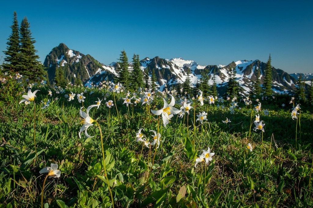
The trail emerges from forest and into a teaser meadow. While you can clearly see the alpine slopes and ridges, you still have a ways to go. There’s more forest and grassy wildflower meadows before you get on the set of switchbacks that end at Appleton Pass.
There are several good tents sites at the pass Water is available from Oyster Lake or, earlier in the summer, from even closer snowfields.

 Trailhead


