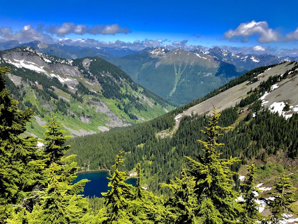
Abiel Peak https://adminonly.wta.org/go-hiking/hikes/abiel-peak https://adminonly.wta.org/site_images/hikes/abiel-peak.jpeg/@@download/image/Abiel Peak.jpeg Abiel Peak Snoqualmie Region > Snoqualmie Pass 47.3528, -121.4703 Map & Directions Sweeping views from Abiel Peak. Photo by WildeHiker. Full-size image Add Hike to My Backpack Saved to My Backpack Continue reading Rating 4.00 out of 5 (1 vote) Log in to rate 60 trip reports for this trail Write a trip report Hiking Abiel Peak Abiel Peak Map & Directions Trailhead Co-ordinates: 47.3528, -121.4703 Open in Google Maps Before You Go See weather forecast WTA Pro Tip: Save a copy of our directions before you leave! App-based driving directions aren't always accurate and data connections may be unreliable as you drive to the trailhead. More Hike Details Trailhead Snoqualmie Region > Snoqualmie Pass Learn Hiking Maps and Why You Need Them Learn Winter Safety Tips You can improve or add to this guidebook entry! Update page


 Trailhead


