Trails for everyone, forever

Home Go Hiking Hiking Guide 360 Trails

360 Trails

Puget Sound and Islands > Seattle-Tacoma Area
47.3891, -122.6839 Map & Directions
Length
2.85 miles, roundtrip
Elevation Gain
200 feet
Highest Point
373 feet
Calculated Difficulty About Calculated Difficulty
Easy
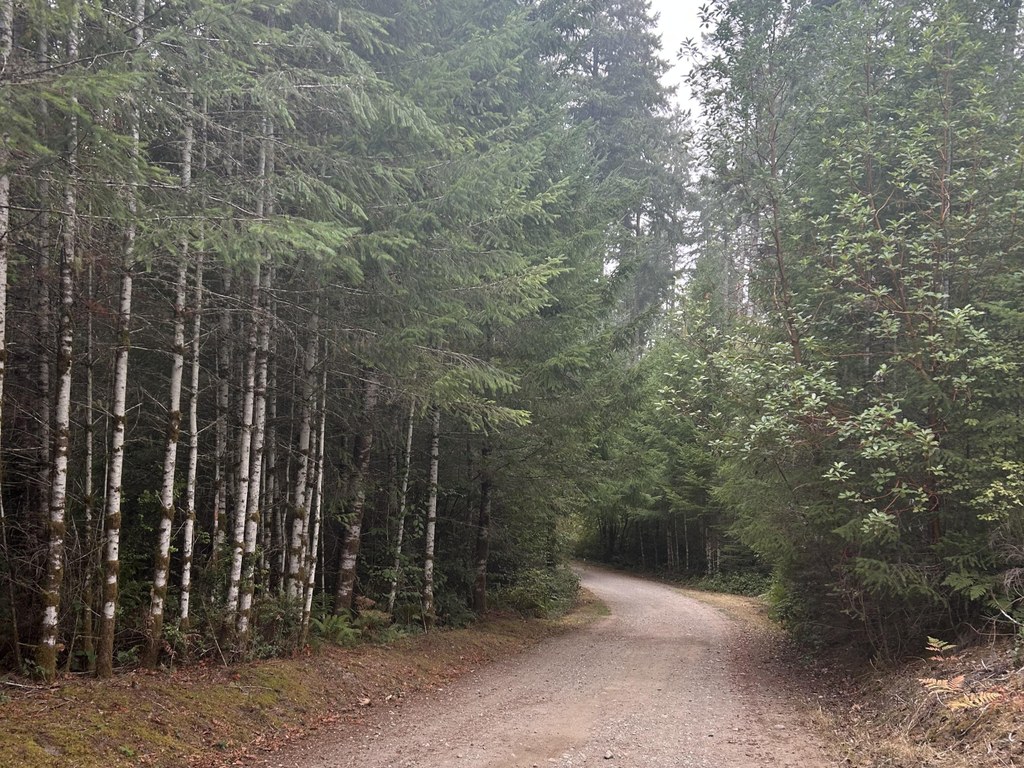
The gravel Main Loop Trail. Photo by Jen Boyd. Full-size image
  • Dogs allowed on leash
  • Fall foliage
  • Good for kids
  • Wildlife

Parking Pass/Entry Fee

None
Saved to My Backpack

This patch of community forest on the north end of the Key Peninsula has a vast network of trails that are open to hikers, equestrians and mountain bikers. Take the Main Loop to explore the network, with many offshoot trails to extend and craft your own hike. Continue reading

Rating
0.00 out of 5

(0 votes) Log in to rate

Hiking 360 Trails

The 360 Trails Main Loop is the primary multi-purpose route. Begin at the trail kiosk near the dog park entrance, just beyond the oversized/equestrian parking area. The trail enters the woods and almost immediately crosses a wide, sturdy bridge over a year-round, brushy stream. The trail stays wide, and the footbed is at times gravel, sandy and rocky, but rarely rooty. The route ascends gently and persistently for 0.3 mile. Take the left turn; this begins the true loop of the Main Loop Trail. At an additional 0.15 mile, bear right.

As you hike clockwise, Main Loop intersects with mountain-bike-dedicated trails throughout the loop. In balance, there are many trails that are hiker- and equestrian-only. The Main Loop remains wide and exposed, but choose any number of other trails to either take a more narrow or more closely forested route. The landscape breaks occasionally to open up to a more clear-cut topography and features the usual Pacific Northwest evergreens, ferns, snowberries, currants and salal. 

At 2.55 total miles, you've completed the lollipop loop; turn left to descend toward the bridge and trailhead.

There are many dog poop stations, picnic tables and benches along the Main Loop, perfect for a snack, nap or rest.

Note: Some sections are one-way routes only open to mountain bikers. Clear signage should indicate where these trails begin and end. 

Toilet Information

  • Toilet at trailhead
  • Toilet has running water

More information about toilets

Hike Description Written by
Jen Boyd, WTA Correspondent

360 Trails

Map & Directions

Trailhead
Co-ordinates: 47.3891, -122.6839 Open in Google Maps

Before You Go

See weather forecast

Parking Pass/Entry Fee

None

WTA Pro Tip: Save a copy of our directions before you leave! App-based driving directions aren't always accurate and data connections may be unreliable as you drive to the trailhead.

Getting There

From Gig Harbor, drive on WA 16, then turn onto WA-302 West/Purdy Key Center. At 0.8 mile, continue onto Purdy Drive. Turn left onto WA-302 for 3.2 miles, then turn right into Gateway Park.

Enter the park and keep straight to find the trailhead. There is ample parking and a trail kiosk to mark the start of the trail system. 

More Hike Details

Trailhead

Puget Sound and Islands > Seattle-Tacoma Area

Key Pen Parks

You can improve or add to this guidebook entry!

360 Trails

6 Trip Reports

Hiked here recently?

Submit a trip report!
 
Trip Reports