Trip Report
Enchanted Valley via East Fork Quinault River — Friday, Apr. 15, 2016
 Olympic Peninsula > Pacific Coast

Find more photos on Instagram!
@_thelonestranger_
#gravescreekhasmoved
I left Seattle after work on Thursday and headed for the south shore of lake Lake Quinault where I would obtain my backcountry camping permit. I arrived to the ranger station after hours (around 10:00pm), so I had to self register for my permit. $5 per person per night (By mail only). I was surprised to learn that no Olympic National Park pass was required to park at the trailhead ...according to Molly at the Olympic National Park Wilderness Information Center.
I thought I had a few people lined up to go with me on this trip, but one-by-one people cancelled on me ...right up to the night before. Oh well, they don't call me the Lone Stranger for no reason.
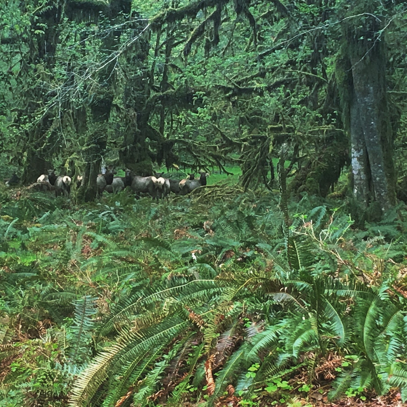
The new (temporary?) trailhead begins approximately 2.5 miles from the Graves Creek campground. This new stretch is an easy road walk that is very scenic and free of obstructions. However, there are several areas where the road has been partially washed out. This is where I saw my first herd of elk.
At Graves Creek campground, the old trailhead, there is a sign reminding you that you need a backcountry permit (oops, I left mine in the truck), which would be a good sign to have had at the new trailhead.
If this hike wasn't for expert hikers before, then it certainly is now. You will need backcountry trail finding skills, creek crossing skills (as many bridges have washed out), bear encounter skills, etc.
It didn't take long after Graves Creek camp before I started seeing fallen trees over the trail. The remainder of the hike would be like running a gauntlet. Wear pants! And tuck in bulky items on your pack. The obstacles require extra time, energy, and add distance to the hike. Each new obstacle presented me with a new bouldering "problem" to solve.
Sometime after O'Neil Creek there is a major washout from the valley flooding. It will look like you need to cross the creek, but don't do this yet. Graves Creek has actually moved from the southeast side of the valley to the northwest. This section lasts for about a quarter of a mile and there are two routes ...a more arduous high route along some game trails, or a low route along the river.
The low route only took me about 15 minutes to complete. Stay as close to the river as possible. You will be walking on logs and sandy riverbed. At the northeast end of the washout you will need to zig-zag across the river on fallen logs.
I was having problems with my new shoes and had wet feet, so I stopped at Pyrite Creek campground for my first night. However, I had plenty of daylight and I now wish I had just continued on into Enchanted Valley.
The next day I hiked up into the top of the valley, just past NASA's weather instrumentation hub. I stayed in the valley for several hours before heading back out to my truck (headlamp required).
I was very disappointed that I did not see any bear on this trip, which seems to be more rare on this hike than actually seeing bear. They could probably smell my musk from a mile away. Haha
Have fun, and be safe!
@_thelonestranger_
#gravescreekhasmoved


Comments