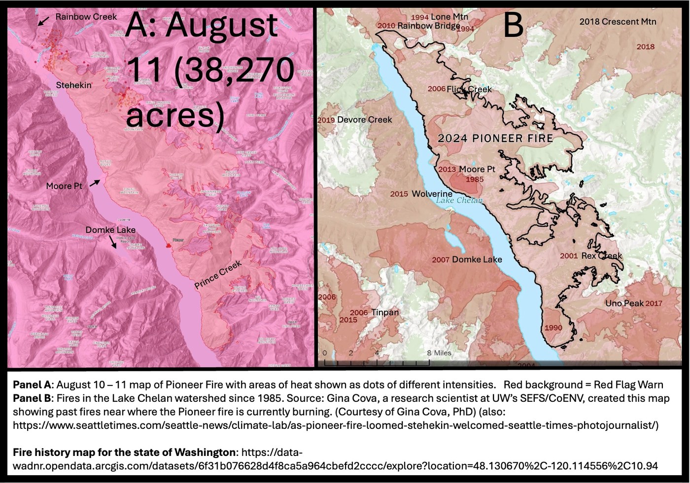
Update for August 11: Fire is at and beyond Stehekin. Excellent photojournalism and associated story in Sunday's Seattle Times. The effort to slow, to divert, and to protect the structures associated with Stehekin and environs is remarkable from the standpoint of both the inhabitants as well as the fire fighters.
Update Status for August 3: Fire is above and extending north of Stehekin. Heat and dry air have resulted in considerable fire growth.
Update Status for August 1: The cooler temperatures and cloudy weather enable fire fighters to work on and with the Stehekin community to make their structures and property more fire resistant (see Figure 3) for an illustration of the spot work occurring. The next eight day plus stretch of hot, dry weather will be critical. The fire is active and continues to expand. The effort by both fire fighters and community members is amazing -- I do not think any of us can imagine how hard this is for all concerned. In many ways, the stress and effort will only abate when it begins to snow.
Recommendation: Get the free app, Watch Duty (however, donations are appreciated as it is a non-profit). It and its associated ‘reporters’ stay on top of almost all of the fires occurring across the west from Washington to California and from Montana to Oklahoma and Texas. You can turn on and off notifications to specific areas (planning a trip to the Crazy Mountains of Montana, for example) or specific ongoing fires.
Updated Status for July 30: Cooler, moister (but no rain) weather has helped. Anticipate heat and greater fire activity to return.
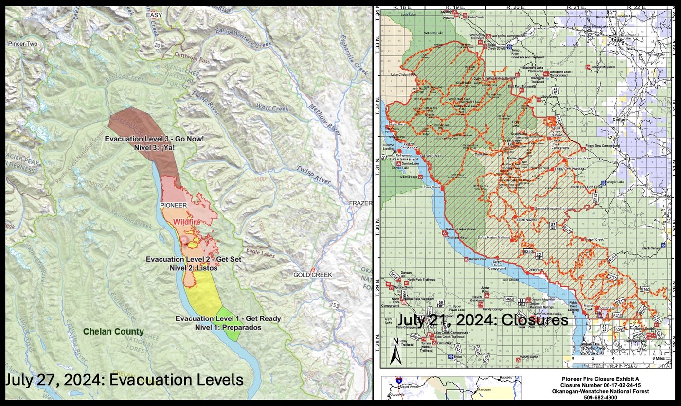
Updated Status for July 27: Level 3 evacuation for Stehekin ordered for 8:00 am, Sunday, July 28.
Updated Status for July 25, 2024: Fire size is over 31,000 acres, more trail closures on the Twisp River side of the Sawtooths, Level 2 Evacuation for Stehekin.
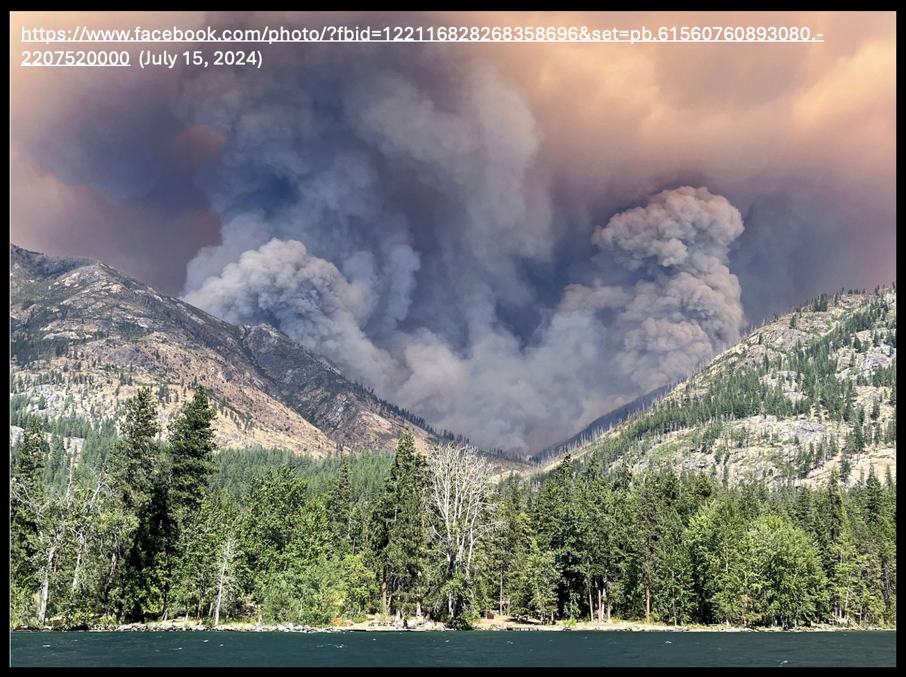
Update Status for July 16, 2024: Fire size is now 20,348 acres; most of the fire activity is east of Moore Point (see Figure 4).
Status for July 8,2024: Pioneer Fire has grown rapidly to 9,055 acres (Figure 1), smoke has greatly increased, and Figure Evaluation and Closures areas have increased. USFS Roads 82, 8020, 8215, 8250 are closed; trails 1248.1, 1250.1, 1254, 1255, 1257, 1258, 1259, 1260, 1261, others (check local Ranger District). USFS trail names do not always correspond with WTA's and many of the minor USFS trails are not found on WTA. Air Quality State wide has become poorer as a result of the heat dome and the fires.
Good sources of information
- The National Incident Information System (inciweb [https://inciweb.wildfire.gov/]) and the Northwest Interagency Coordination Center (has morning briefings [https://gacc.nifc.gov/nwcc/]). Maps in Figure 1 show the borders and hot spots associated with the fire. It is important to realize that this is the best estimate and that the fire damage within this perimeter will range from no effect to total destruction.
- The Current Wildfire Incident Information for Washington State; this site is maintained by the WA Dept of Natural Resources (https://www.dnr.wa.gov/Wildfires) . Part way down on this page is ‘Active Wildfires in Washington’ and below that is the ‘DNR Wildfire Intel Dashboard. Make sure you check the box that says next to it: “I recognize the intended use of this dashboard and wish t…” Check this and the box saying ‘Go to the Dashboard’ becomes active.
- A source I discovered several weeks ago from the Kitsap Sun online Newspaper. This includes a map, heat, and smoke and smoke direction (https://datacentral.kitsapsun.com/fires/).
All of these sources will have links to the closures, but there are separate websites for each US Forest Ranger District, for each National Park (e.g., for North Cascades: https://www.nps.gov/noca/index.htm), Recreation Area, or Monument. WS Dot has a map of closures (https://wsdot.com/Travel/Real-time/Map/).
All these agencies or groups have twitter and Facebook pages.
Finally, there are no closures, and you can go. Three last things to check: avalanche danger (seasonally appropriate), weather (always appropriate), and air quality. Two good sites for air quality:
- Purple air
- Kitsap Sun again is recommended.
Mt Mike provided these additional resources:
- For smoke forecasts in WA state, I recommend the interagency smoke page at https://wasmoke.blogspot.com/. The Canadian smoke forecast at https://firesmoke.ca/forecasts/current/ also includes the US.
- For fire locations nationwide, you can also look at the ESRI Wildfire map that shows info from a number of sources at https://livingatlas.arcgis.com/wildfireaware/#.
There are many other sites, but I (and Mt Mike regarding the last 2) have found these to be consistently reliable and informative.
Let’s hope for a great summer and early fall with few or no fires.


Comments
Mt Mike on Summer Blossom, War Creek, Uno Peak, Chelan Lakeshore Trail, Crater Lakes, Foggy Dew Creek, Libby Lake, North Fork Prince Creek, Oval Lakes, Prince Creek, Silver Lake
Thanks for the resources! For smoke forecasts in WA state, I recommend the interagency smoke page at https://wasmoke.blogspot.com/. The Canadian smoke forecast at https://firesmoke.ca/forecasts/current/ also includes the US. For fire locations nationwide, you can also look at the ESRI Wildfire map that shows info from a number of sources at https://livingatlas.arcgis.com/wildfireaware/#.
Posted by:
Mt Mike on Jun 20, 2024 10:34 PM
JamesHaitch on Summer Blossom, War Creek, Uno Peak, Chelan Lakeshore Trail, Crater Lakes, Foggy Dew Creek, Libby Lake, North Fork Prince Creek, Oval Lakes, Prince Creek, Silver Lake
This is a very good reason for WTA to include the USFS trail numbers on all hike names. WTA needs to use common sense. There's multiple hikes that have the exact same name, crazy. Be safe.
Posted by:
JamesHaitch on Jul 10, 2024 02:51 PM
Washington Trails Association on Summer Blossom, War Creek, Uno Peak, Chelan Lakeshore Trail, Crater Lakes, Foggy Dew Creek, Libby Lake, North Fork Prince Creek, Oval Lakes, Prince Creek, Silver Lake
Hi James - Our hiking guide entries for FS trails do include the number! Its listed to the right of the driving directions, in the section where we list the land manager for the trail as well as maps and guidebooks for it. You can find trails by number using the search bar at the top of page. Hope that helps!
Posted by:
Washington Trails Association on Jul 19, 2024 08:51 AM
onewhohikes on Summer Blossom, War Creek, Uno Peak, Chelan Lakeshore Trail, Crater Lakes, Foggy Dew Creek, Libby Lake, North Fork Prince Creek, Oval Lakes, Prince Creek, Silver Lake
No word on cause of the Shoofly fire?
Posted by:
onewhohikes on Jul 16, 2024 05:41 AM
Abam on Summer Blossom, War Creek, Uno Peak, Chelan Lakeshore Trail, Crater Lakes, Foggy Dew Creek, Libby Lake, North Fork Prince Creek, Oval Lakes, Prince Creek, Silver Lake
I have not seen any report. Current size is 104 acres and appears to be under control (contained by water drops and fuel availability).
Posted by:
Abam on Jul 16, 2024 09:43 AM
Abam on Summer Blossom, War Creek, Uno Peak, Chelan Lakeshore Trail, Crater Lakes, Foggy Dew Creek, Libby Lake, North Fork Prince Creek, Oval Lakes, Prince Creek, Silver Lake
Shoofly Fire is regarding as contained.
Posted by:
Abam on Jul 25, 2024 10:40 AM
Traillesstraveled on Summer Blossom, War Creek, Uno Peak, Chelan Lakeshore Trail, Crater Lakes, Foggy Dew Creek, Libby Lake, North Fork Prince Creek, Oval Lakes, Prince Creek, Silver Lake
It really is a shame that the Pioneer fire was almost out and someone in their lack of brain engagement decided it was ok to backburn private property area.
Posted by:
Traillesstraveled on Aug 06, 2024 06:11 AM