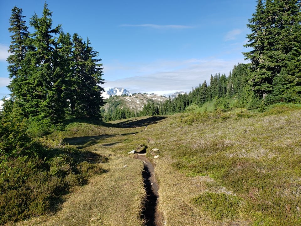
Did a 2-night backpacking trip from Hannegan trailhead to nearly the end of Copper Ridge, with the middle day being an out-and-back day hike. We started July 21st and came out July 23rd. Before getting into the details of the hike, I wanted to first mention that I lost my personal camera somewhere along the dirt road to the trailhead. After exiting the trail on the 23rd, I set my camera on the roof of my car (classic, stupid mistake) to load my backpacking gear, and I forgot the camera there. I'm assuming the camera fell off fairly close to the parking lot, but I wasn't able to find it. It may have bounced off the road or been stolen, but if you happen to find a Nikon D3500 anywhere near Hannegan trailhead, please contact WTA and/or take it to the Forest Service ranger station in Glacier. Okay, now on to the trip report.
Day 1
The hike up to Hannegan Pass from the trailhead is a relatively pleasant grade, rising 2000ft in about 4 miles. It is very exposed, though, so make sure you protect yourself from the sun. We started hiking around 8:30am and made it to Hannegan Pass in 2 hours without incident. There is water along this section of the trail, but I wouldn't say it is abundant. Definitely carry enough water with you to make it to the Pass at least. From Hannegan Pass, we hiked a mile down to Boundary Camp (where we saw marmots AND a pika!) and hung a left up Copper Ridge. We ran into a group that mention they had seen a momma bear with cubs hanging around Boundary, so be alert and loud. If you are at all unsure if you should fill up water before starting to hike up the Ridge, just go ahead and fill up at Boundary Camp. There is almost no water between Boundary and Silesia/Egg Lake Camps, and I expect it to become even more scarce in August and September.
The climb up to the Ridge is a solid set of switchbacks that don't really let up, but they weren't too bad going slow and steady. We were not anticipating the number and size of the hills on top of Copper Ridge, so just know that this trip will test all of your leg muscles and joints each day. We stayed at Silesia Camp, and despite the clouds, the views were absolutely incredible.
Total elevation gain: ~3500ft
Total elevation loss: ~1100ft
Day 2
We used our middle day to hike the length of the Ridge as an out-and-back to our Silesia camp. The hike from Silesia up to Copper Lookout is challenging but very doable - just don't let the distances on the maps fool you into thinking it's a quick walk. We had to cross a few patches of snow that I expect will melt out very soon. Copper Lookout provides some of the best views in the park that you can get to on a regular hiking trail. Plenty of wildflowers along the way, but many seem to have been scorched in the recent heat. There are some overly bold marmots up there with some very cute pups, and someone in my group even saw some ptarmigan. The hike down to Copper Lake is a real knee-jerker on lots of loose rock, so be careful. There is plenty of water at Copper Lake and after. Once we passed the Lake, we kept going for another 3-ish miles, which was really very easy. The trail mostly evens out and doesn't rise or fall much before it starts going down into the Chilliwack Valley, but we didn't make it that far.
This was the first day we really dealt with any bugs, too. They seemed to be pretty abundant at Copper Lake and farther north, mostly little flies and mosquitoes. They weren't too bothersome, but I was wearing long pants and sleeves too.
If you are hiking from Copper Lake towards Silesia/Egg Lake Camps, make sure to fill up on water around Copper Lake. The climb up to the Lookout is tough and you may use up your water before you'd like if you're already low.
Total elevation gain: ~3000ft
Total elevation loss: ~3000ft
Day 3
Our hike out was just a reverse of our first day, but way buggier. Things were fine until we started hiking down from Hannegan Pass, which we hit mid-day when everything was warmed up. Stopping on that last section of trail, even just to let other hikers pass, meant getting swarmed by flies and mosquitos. They weren't too painful, but they were extremely annoying. I also got pretty sunburnt on my face there.
Total elevation gain: ~1100ft
Total elevation loss: ~3500ft
Summary
Overall, this hike is really some of the best backpacking in the region. Getting a permit is very difficult, though, and conditions now are more like typical mid-August conditions rather than late July. So, for anyone reading this in 2022 or beyond, there may be more snow on the trail in late July in the coming years. Of course, if we keep getting monster heat waves, there may actually be less snow. Definitely pay attention to each summer's weather history in addition to checking trail reports.


Comments