Since the weather forecasts said it would be a warm day -- in the 80s -- we decided to do a variation on the hike described in the WTA Hiking Guide.
Everyone in our small group had driven separately so we had plenty of cars available for a car shuttle. We dropped cars at the lower Buck Creek Trailhead near the Mount Adams Horse Camp. Then, suitably masked up, we shuttled up to Wicky Shelter to start our hike.
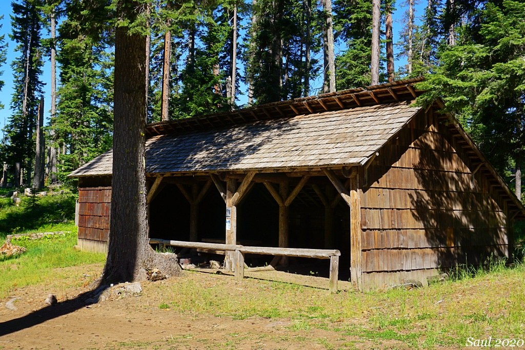
Wicky Shelter was built by the CCC's in 1939 as a warming hut for a rudimentary downhill ski run with rope tow on the slope above Forest Road 80. The shelter is maintained these days as a historic structure. Dispersed camping is permitted around the shelter but not inside the shelter.
We started our hike by taking Wicky Shelter connector trail 39A to its junction with the Morrison Creek Trail. We then followed the Morrison Creek Trail northwest towards the White Salmon River. This trail traverses previously logged forest and a long section of it is on a former logging road so it doesn't offer a lot of scenic or diversity value. Highlights were the bridge over Morrison Creek and a small spring that provided a good spot where its flow crossed the trail for my dog to get a drink.
At 1.4 miles, we reached the junction with the Buck Creek Trail and turned onto it. Once again, we were hiking on former logging roads much of the time as we descended into the Buck Creek drainage. When we reached the bridge over Buck Creek, we stopped for lunch in the wide flat area that provided opportunities for physical distance in the cool shade next to the creek.
We continued descending the Buck Creek Trail until we reached the breaks above the White Salmon River, where the trail turned 90 degrees south to parallel the river. We had hiked 3.7 miles.
This was the most scenic and interesting stretch of our hike. We could hear the White Salmon River in its box canyon but any view of water was blocked by trees and rock outcrops.
We took an unsigned side trail a few yards to see the springs that form the headwaters of Spring Creek. This was another cool and shady rest stop.
Continuing on the Buck Creek Trail, we crossed the bridge over Spring Creek and then climbed steeply to dry, open cliff tops above the White Salmon Canyon. The flora changed dramatically to Oregon white oaks, large clumps of blooming Shrubby Penstemon, Nine-leaf Desert Parsley, Harsh Paintbrush, and Northern Buckwheat among many native plants in bloom.
One final trail descent took us back into moister conifer forest in the Morrison Creek Canyon where we crossed it just above its confluence with the White Salmon River. Then we had a stiff climb up the ridge to reach the level of the breaks. A short walk through the woods brought us to the trailhead and our waiting cars.
This was a nice mostly downhill 6-mile hike for a warm day and we did not see anyone else.
We compiled bird and plant lists for the hike. Links below.


Comments
Zipster on Buck Creek-Morrison Creek-Wicky Creek Loop
Thanks for the trip report and links to the impressive plant & bird lists. This coming weekend, I plan to head up FR80 and your report will be my guide. As not familiar with the area, I'm having difficulty finding the location of Spring Creek. On the USGS topo map, a couple possibilities: Is it south of Buck Creek and north of Wicky Creek, and flows south into the White Salmon? Or, is it a south-flowing ephemeral creek that appears to cross FR8031 at ~3200' elevation, drains into an un-named creek that in turn drains into Buck Creek? Also, instead of this Buck Creek loop, I want open meadow wildflower hikes that can be accessed via roads leading north from Trout Lake - do you have recommendations? Many thanks.
Posted by:
Zipster on May 12, 2021 01:48 PM
Sunrise Creek on Buck Creek-Morrison Creek-Wicky Creek Loop
If you follow my hike description, Spring Creek is a short stream south of Buck Creek and north of Morrison Creek. It flows directly into the White Salmon River. The landscape is predominantly forested north of Trout Lake. I don't know of any open wildflower meadow hikes that are accessible at this time of year. Snow still is covering the subapline meadows on Mount Adams. According to the USFS website, Forest Road 80 to the South Climb trailhead on Mount Adams still is blocked by snow. Based on reports I have seen online, the best wildflower hikes now are on the open ridges around Yakima, Ellensburg and Wenatchee so you may be going to the wrong place if your objective is open meadow wildflower hikes.
Posted by:
Sunrise Creek on May 12, 2021 02:25 PM
Zipster on Buck Creek-Morrison Creek-Wicky Creek Loop
Thanks for help in finding Spring Creek. And, also in confirming that meadows around Mt Adams are not yet accessible. This Spring I've already enjoyed the wildflower areas around Yakima and Ellensburg, as noted in my WTA trip reports. Other parts of the halleyhosting website are really helpful (http://science.halleyhosting.com/nature/bloomtime/cascade/wa/casc.htm) Enjoy the season!
Posted by:
Zipster on May 12, 2021 07:02 PM